This application visualizes African Aid projects. The data comes from USAID, World Bank, and various NGO's. All of the data points were obtained from aiddata.org.
View Aid Visualizations
Step 1
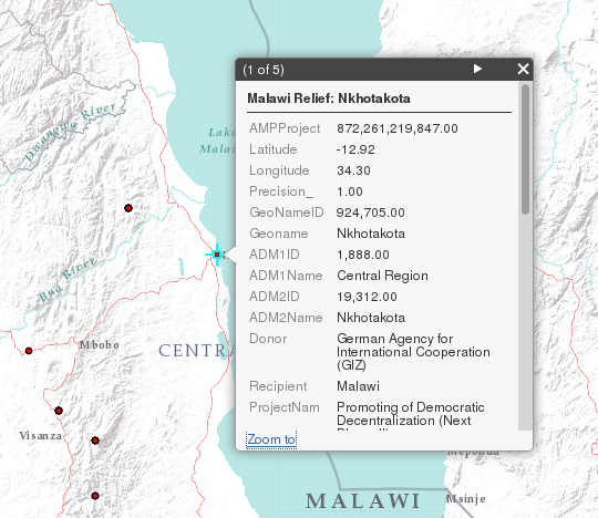
The map will load with the all aid data showing. Click on any project point and a popup will show with additional information. Some areas may have multiple projects in the same location. To view these other projects' information, click on the arrow in the popup header.
Step 2
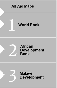
To show a subset of the aid data, click on one of the categories in the left panel. The map will display only the aid information from this category.
Step 3
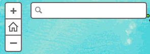
To find a specific location, enter an address into the search bar and press Enter. The map should zoom to your location.
Step 4
To view legend information on the visible layer, click "Legend".